

By Perla Rivadeneyra
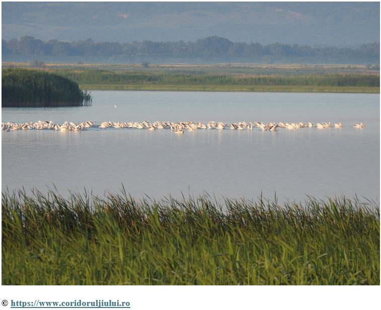
Lake Bistreț, located in Dolj County in southern Romania, represents one of the demonstration sites of the Horizon Europe EUROLakes project. The area includes important wetland ecosystems and Natura 2000 protected areas, while simultaneously facing socio-economic pressures and the challenge of balancing ecological protection with local development opportunities. Within this context, the EUROLakes project implemented a GIS-based Participatory Multi-Criteria Analysis (S-PMCA) to explore suitable areas for the development of a low-impact eco-trail intended to promote sustainable tourism while safeguarding biodiversity.
The Bistreț case was designed as a spatially explicit decision-support exercise integrating stakeholder preferences, ecological information, and accessibility considerations into a transparent suitability assessment process.
Turning stakeholder priorities into spatial insights
The main objective of the PMCA in Lake Bistreț was not to define a final eco-trail route, but rather to identify areas that could be considered more attractive for potential eco-trail development under different ecological and accessibility spatial criteria. The approach was intended to facilitate discussion among stakeholders and support exploratory planning.
The PMCA followed several methodological steps:
- Definition of the Area of Interest;
- Identification of relevant spatial criteria;
- Standardisation and normalisation of criteria layers;
- Participatory weighting of criteria through stakeholder engagement;
- Spatial aggregation through the Weighted Ordered Weighted Average (WOWA) operator;
- Aggregation and interpretation of results within the mDSS environment.
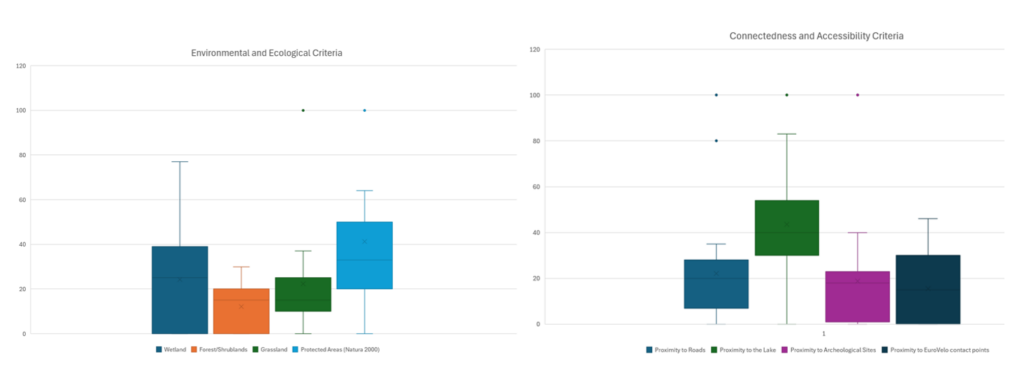
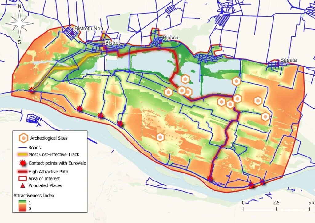
The analysis grouped criteria into two main categories: (i) Environmental and Ecological Criteria, including proximity to the lake, Natura 2000 protected areas, wetlands, and land-cover characteristics; and (ii) Connectivity and Accessibility Criteria, including proximity to roads, settlements, archaeological sites, and EuroVelo infrastructure.
A participatory workshop was organised with institutional stakeholders and local actors, where participants discussed the criteria and assigned relative importance weights to the different variables and categories.
The most attractive areas for eco-trail development
The PMCA results showed that stakeholders consistently assigned higher importance to Protected Areas and Wetland areas (among the Environmental and Ecological Criteria), whereas among the Connectedness and Accessibility Criteria Proximity to the Lake ranked highest.
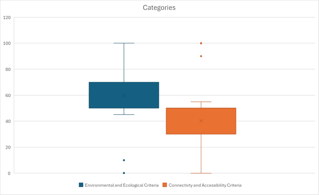
Finally, categories were also weighted separetly, here, stakeholders assigned a higher weight to environmental and ecological criteria.
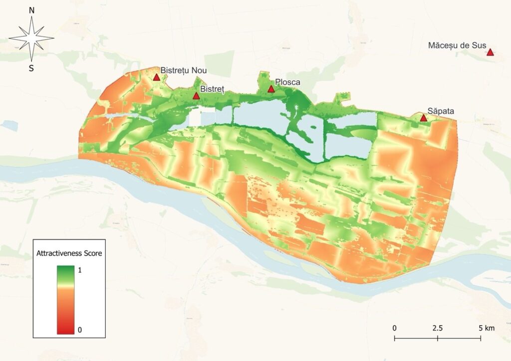
The weights were later assigned to the spatial layers and aggregated to compute a single Attractiveness Index for the Eco-Trail.
The resulting Attractiveness Index identified the central wetland-lake corridor as the area with the highest overall suitability for potential eco-trail development. Areas close to the lake and protected wetland systems generally exhibited the highest attractiveness scores due to their ecological value and landscape characteristics.
The spatial analysis also explored two alternative routing logics:
- a more cost-effective path based on pixel-level optimisation;
- a more attractive route integrating ecological, accessibility, and cultural considerations.
Importantly, the deliverable explicitly states that these routes should not be interpreted as final implementation proposals, but rather as exploratory outputs intended to support dialogue, scenario exploration, and participatory planning.
The Lake Bistreț case demonstrates how GIS-based PMCA can support restoration and sustainable development planning by acting as a boundary object between ecological science, institutional priorities, and local development objectives. Rather than producing a single “optimal” solution, the approach helped make trade-offs and stakeholder priorities explicit.